<rss version="2.0">
    <link rel="self" type="application/atom+xml" href="/rss/1/productlistings/navigation/cat186"/>
      <link rel="first" href="/rss/1/productlistings/navigation/cat186"/>
          <link rel="last" href="/rss/1/productlistings/navigation/cat186?page=1"/>
    <channel>
    <title>Navigation from Gaynor Sports</title>
    <link>http://www.gaynors.co.uk/rss/1/productlistings/navigation/cat186</link>
    <description>View items from our Navigation category</description>
    <copyright>Copyright 2026 Gaynor Sports</copyright>
    <language>en</language>
    <lastBuildDate>Mon, 12 Oct 2026 09:00:42 +0100</lastBuildDate>
    <pubDate>Mon, 12 Oct 2026 09:00:42 +0100</pubDate>
              <item>
              <pubDate>Mon, 12 Oct 2026 03:50:30 +0100</pubDate>
              <title>Adventure Compass</title>
              <description><a href="/equipment-c153/navigation-c186/adventure-compass-p11436"><img src="data:image/gif;base64,R0lGODlhAQABAIAAAAAAAP///yH5BAEAAAAALAAAAAABAAEAAAIBRAA7" data-src="https://www.gaynors.co.uk/images/products/thumbnails/1568725680-83707200.jpg" alt="Adventure Compass"  class="lazyload" /></a>
<p><a href="/equipment-c153/navigation-c186/adventure-compass-p11436">Adventure Compass</a></p>
<p>Weight: 35g

Rotating bezel marked with two degree dial graduations
Romer scales 1:25,000 and 1:50,000
Centimetre ruler
Luminous needle markings for night navigation
Neck cord included
</p></description>
              <guid>/equipment-c153/navigation-c186/adventure-compass-p11436</guid>
              <link>/equipment-c153/navigation-c186/adventure-compass-p11436</link>
            </item>
          <item>
              <pubDate>Mon, 12 Oct 2026 03:50:35 +0100</pubDate>
              <title>Central Lake District Map</title>
              <description><a href="/equipment-c153/travel-c174/books-c212/central-lake-district-map-p35127"><img src="data:image/gif;base64,R0lGODlhAQABAIAAAAAAAP///yH5BAEAAAAALAAAAAABAAEAAAIBRAA7" data-src="https://www.gaynors.co.uk/images/products/thumbnails/1778657231-47360700.jpg" alt="Central Lake District Map"  class="lazyload" /></a>
<p><a href="/equipment-c153/travel-c174/books-c212/central-lake-district-map-p35127">Central Lake District Map</a></p>
<p>Features

Ordnance Survey Explorer mapping 1:25,000 scale.
Size Flat: 960mm x 694mm.
Size Folded: 230mm x 120mm
</p></description>
              <guid>/equipment-c153/travel-c174/books-c212/central-lake-district-map-p35127</guid>
              <link>/equipment-c153/travel-c174/books-c212/central-lake-district-map-p35127</link>
            </item>
          <item>
              <pubDate>Mon, 12 Oct 2026 03:50:37 +0100</pubDate>
              <title>Compass</title>
              <description><a href="/equipment-c153/navigation-c186/compass-p9372"><img src="data:image/gif;base64,R0lGODlhAQABAIAAAAAAAP///yH5BAEAAAAALAAAAAABAAEAAAIBRAA7" data-src="https://www.gaynors.co.uk/images/products/thumbnails/1542211793-82550900.jpg" alt="Compass"  class="lazyload" /></a>
<p><a href="/equipment-c153/navigation-c186/compass-p9372">Compass</a></p>
<p>
Map measuring scales: 1.25km &amp;amp; 1.63 miles
Magnifying lens viewer included
Strong, durable &amp;amp; lightweight
Lanyard included
</p></description>
              <guid>/equipment-c153/navigation-c186/compass-p9372</guid>
              <link>/equipment-c153/navigation-c186/compass-p9372</link>
            </item>
          <item>
              <pubDate>Mon, 12 Oct 2026 03:50:37 +0100</pubDate>
              <title>Compass Expedition 4-360</title>
              <description><a href="/equipment-c153/navigation-c186/silva-compass-expedition-4-360-p9427"><img src="data:image/gif;base64,R0lGODlhAQABAIAAAAAAAP///yH5BAEAAAAALAAAAAABAAEAAAIBRAA7" data-src="https://www.gaynors.co.uk/images/products/thumbnails/1541063595-62259500.jpg" alt="Compass Expedition 4-360"  class="lazyload" /></a>
<p><a href="/equipment-c153/navigation-c186/silva-compass-expedition-4-360-p9427">Compass Expedition 4-360</a></p>
<p>Weight: 36g

Luminous markings for navigation in the dark
Magnifying lens
Large and easy to grip
Stencil holes for accurate placement
Red and white classic needle
</p></description>
              <guid>/equipment-c153/navigation-c186/silva-compass-expedition-4-360-p9427</guid>
              <link>/equipment-c153/navigation-c186/silva-compass-expedition-4-360-p9427</link>
            </item>
          <item>
              <pubDate>Mon, 12 Oct 2026 03:50:37 +0100</pubDate>
              <title>Compass Field</title>
              <description><a href="/equipment-c153/navigation-c186/silva-compass-field-p9426"><img src="data:image/gif;base64,R0lGODlhAQABAIAAAAAAAP///yH5BAEAAAAALAAAAAABAAEAAAIBRAA7" data-src="https://www.gaynors.co.uk/images/products/thumbnails/1541081594-68444800.jpg" alt="Compass Field"  class="lazyload" /></a>
<p><a href="/equipment-c153/navigation-c186/silva-compass-field-p9426">Compass Field</a></p>
<p>Weight:&amp;nbsp;28g

Dryflex rubber grip for easy handling of the compass
Detachable safety lanyard
Declination scale inside the capsule
Map measuring scales in mm, 1:50k and 1:25k compatible with most maps
Detachable safety-release lanyard
</p></description>
              <guid>/equipment-c153/navigation-c186/silva-compass-field-p9426</guid>
              <link>/equipment-c153/navigation-c186/silva-compass-field-p9426</link>
            </item>
          <item>
              <pubDate>Mon, 12 Oct 2026 03:50:39 +0100</pubDate>
              <title>Deluxe Map Compass</title>
              <description><a href="/equipment-c153/navigation-c186/deluxe-map-compass-p33372"><img src="data:image/gif;base64,R0lGODlhAQABAIAAAAAAAP///yH5BAEAAAAALAAAAAABAAEAAAIBRAA7" data-src="https://www.gaynors.co.uk/images/products/thumbnails/1753367479-07415200.jpg" alt="Deluxe Map Compass"  class="lazyload" /></a>
<p><a href="/equipment-c153/navigation-c186/deluxe-map-compass-p33372">Deluxe Map Compass</a></p>
<p>Weight: 25gFeatures

Luminous N, E, S, W markings, dial and index pointer
Magnifying viewer
Meridian lines
Lanyard included
Romer Scale: 1:25000, 1:50000
Graduations: 2º, 10º, 20º
Dimensions 12.5cm x 6cm x 1.5cm
Material Acrylic &amp;amp; ABS
</p></description>
              <guid>/equipment-c153/navigation-c186/deluxe-map-compass-p33372</guid>
              <link>/equipment-c153/navigation-c186/deluxe-map-compass-p33372</link>
            </item>
          <item>
              <pubDate>Mon, 12 Oct 2026 03:50:41 +0100</pubDate>
              <title>Expedition Compass</title>
              <description><a href="/equipment-c153/navigation-c186/silva-expedition-compass-p16442"><img src="data:image/gif;base64,R0lGODlhAQABAIAAAAAAAP///yH5BAEAAAAALAAAAAABAAEAAAIBRAA7" data-src="https://www.gaynors.co.uk/images/products/thumbnails/1601907617-29462700.jpg" alt="Expedition Compass"  class="lazyload" /></a>
<p><a href="/equipment-c153/navigation-c186/silva-expedition-compass-p16442">Expedition Compass</a></p>
<p>Specification

Weight: 50g
Attachment: Detachable safety-release scale lanyard
Clinometer: Yes
Declination adjustment: Permanent adjustment for local magnetic declination
Magnifying lens: Yes
Scales: 1:25k, 1:40k, 1:50k, GPS scales, Lanyard; 1:25, / 1:50, mm, inch
Silicon friction feet: Yes
Variant: Magnetic Equator, Magnetic South, Magnetic North
Slope card: Yes

Features

SCALE LANYARD: 2 scales, soft and bendable, easy to place directly on to your route on the map.
SLOPE CARD: Calculate avalanche risk, determine how challenging your journey will be
</p></description>
              <guid>/equipment-c153/navigation-c186/silva-expedition-compass-p16442</guid>
              <link>/equipment-c153/navigation-c186/silva-expedition-compass-p16442</link>
            </item>
          <item>
              <pubDate>Mon, 12 Oct 2026 03:50:41 +0100</pubDate>
              <title>Explorer 5 Lake District - North Eastern</title>
              <description><a href="/equipment-c153/navigation-c186/explorer-5-lake-district-north-eastern-p31949"><img src="data:image/gif;base64,R0lGODlhAQABAIAAAAAAAP///yH5BAEAAAAALAAAAAABAAEAAAIBRAA7" data-src="https://www.gaynors.co.uk/images/products/thumbnails/1734963354-51376700.jpg" alt="Explorer 5 Lake District - North Eastern"  class="lazyload" /></a>
<p><a href="/equipment-c153/navigation-c186/explorer-5-lake-district-north-eastern-p31949">Explorer 5 Lake District - North Eastern</a></p>
<p></p></description>
              <guid>/equipment-c153/navigation-c186/explorer-5-lake-district-north-eastern-p31949</guid>
              <link>/equipment-c153/navigation-c186/explorer-5-lake-district-north-eastern-p31949</link>
            </item>
          <item>
              <pubDate>Mon, 12 Oct 2026 03:50:41 +0100</pubDate>
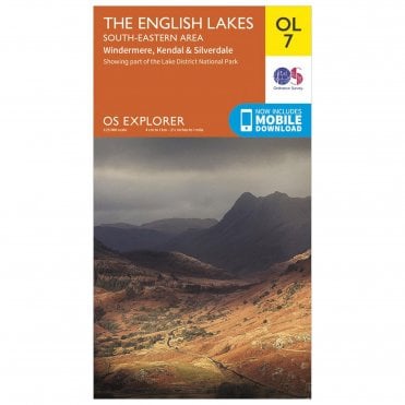
              <title>Explorer 7 Lake District - South Eastern</title>
              <description><a href="/equipment-c153/navigation-c186/ordnance-survey-explorer-7-lake-district-south-eastern-p9387"><img src="data:image/gif;base64,R0lGODlhAQABAIAAAAAAAP///yH5BAEAAAAALAAAAAABAAEAAAIBRAA7" data-src="https://www.gaynors.co.uk/images/products/thumbnails/1543415031-38357100.jpg" alt="Explorer 7 Lake District - South Eastern"  class="lazyload" /></a>
<p><a href="/equipment-c153/navigation-c186/ordnance-survey-explorer-7-lake-district-south-eastern-p9387">Explorer 7 Lake District - South Eastern</a></p>
<p>
Area covered - Windermere, Kendal &amp;amp; Silverdale
1:25 000 scale / 4 cm to 1 km or 2½ inches to 1 mile
Picnic areas and viewpoints
Selected places of interest
Rights of way information for England and Wales
National Trail and Recreational Path routes shown
Selected Tourist information
Double sided
</p></description>
              <guid>/equipment-c153/navigation-c186/ordnance-survey-explorer-7-lake-district-south-eastern-p9387</guid>
              <link>/equipment-c153/navigation-c186/ordnance-survey-explorer-7-lake-district-south-eastern-p9387</link>
            </item>
          <item>
              <pubDate>Mon, 12 Oct 2026 03:50:41 +0100</pubDate>
              <title>Explorer Active 4 Lake District - North Western</title>
              <description><a href="/equipment-c153/navigation-c186/explorer-active-4-lake-district-north-western-p9390"><img src="data:image/gif;base64,R0lGODlhAQABAIAAAAAAAP///yH5BAEAAAAALAAAAAABAAEAAAIBRAA7" data-src="https://www.gaynors.co.uk/images/products/thumbnails/1543415079-41136300.jpg" alt="Explorer Active 4 Lake District - North Western"  class="lazyload" /></a>
<p><a href="/equipment-c153/navigation-c186/explorer-active-4-lake-district-north-western-p9390">Explorer Active 4 Lake District - North Western</a></p>
<p>
Area covered - Keswick, Cockermouth &amp;amp; Wigton
1:25 000 scale / 4 cm to 1 km or 2½ inches to 1 mile
Camping and Caravan sites
Picnic areas and viewpoints
Selected places of interest
Rights of way information for England and Wales
National Trail and Recreational Path routes shown
Selected Tourist information
Double sided
Use washable ink to highlight your routes
</p></description>
              <guid>/equipment-c153/navigation-c186/explorer-active-4-lake-district-north-western-p9390</guid>
              <link>/equipment-c153/navigation-c186/explorer-active-4-lake-district-north-western-p9390</link>
            </item>
          <item>
              <pubDate>Mon, 12 Oct 2026 03:50:41 +0100</pubDate>
              <title>Explorer Active 6 Lake District - South Western</title>
              <description><a href="/equipment-c153/navigation-c186/explorer-active-6-lake-district-south-western-p9394"><img src="data:image/gif;base64,R0lGODlhAQABAIAAAAAAAP///yH5BAEAAAAALAAAAAABAAEAAAIBRAA7" data-src="https://www.gaynors.co.uk/images/products/thumbnails/1543415793-65922700.jpg" alt="Explorer Active 6 Lake District - South Western"  class="lazyload" /></a>
<p><a href="/equipment-c153/navigation-c186/explorer-active-6-lake-district-south-western-p9394">Explorer Active 6 Lake District - South Western</a></p>
<p>
Area covered - Coniston, Ulverston &amp;amp; Barrow-in-Furness
1:25 000 scale / 4 cm to 1 km or 2½ inches to 1 mile
Camping and Caravan sites
Picnic areas and viewpoints
Selected places of interest
Rights of way information for England and Wales
National Trail and Recreational Path routes shown
Selected Tourist information
Double sided
Use washable ink to highlight your routes
</p></description>
              <guid>/equipment-c153/navigation-c186/explorer-active-6-lake-district-south-western-p9394</guid>
              <link>/equipment-c153/navigation-c186/explorer-active-6-lake-district-south-western-p9394</link>
            </item>
          <item>
              <pubDate>Mon, 12 Oct 2026 03:50:41 +0100</pubDate>
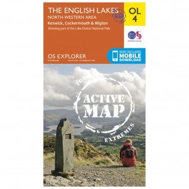
              <title>Explorer Active 7 Lake District - South Eastern</title>
              <description><a href="/equipment-c153/navigation-c186/ordnance-survey-explorer-active-7-lake-district-south-eastern-p9395"><img src="data:image/gif;base64,R0lGODlhAQABAIAAAAAAAP///yH5BAEAAAAALAAAAAABAAEAAAIBRAA7" data-src="https://www.gaynors.co.uk/images/products/thumbnails/1543415911-17165800.jpg" alt="Explorer Active 7 Lake District - South Eastern"  class="lazyload" /></a>
<p><a href="/equipment-c153/navigation-c186/ordnance-survey-explorer-active-7-lake-district-south-eastern-p9395">Explorer Active 7 Lake District - South Eastern</a></p>
<p>
Area covered - Windermere, Kendal &amp;amp; Silverdale.
1:25 000 scale / 4 cm to 1 km or 2½ inches to 1 mile
Camping and Caravan sites
Picnic areas and viewpoints
Selected places of interest
Rights of way information for England and Wales
National Trail and Recreational Path routes shown
Selected Tourist information
Double sided
Use washable ink to highlight your routes
</p></description>
              <guid>/equipment-c153/navigation-c186/ordnance-survey-explorer-active-7-lake-district-south-eastern-p9395</guid>
              <link>/equipment-c153/navigation-c186/ordnance-survey-explorer-active-7-lake-district-south-eastern-p9395</link>
            </item>
          <item>
              <pubDate>Mon, 12 Oct 2026 09:00:42 +0100</pubDate>
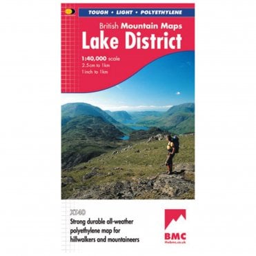
              <title>Lake District 1:40,000</title>
              <description><a href="/equipment-c153/navigation-c186/harvey-maps-lake-district-1-40-000-p9399"><img src="data:image/gif;base64,R0lGODlhAQABAIAAAAAAAP///yH5BAEAAAAALAAAAAABAAEAAAIBRAA7" data-src="https://www.gaynors.co.uk/images/products/thumbnails/1541000257-78758400.jpg" alt="Lake District 1:40,000"  class="lazyload" /></a>
<p><a href="/equipment-c153/navigation-c186/harvey-maps-lake-district-1-40-000-p9399">Lake District 1:40,000</a></p>
<p>
Printed on polyethylene - durable, tear-resistant and 100% waterproof
Made in cooperation with the British Mountaineering Council
Colour shading for easy identification of hills and valleys
Detailed crag information for climbers
Less than half the weight of a laminated map
Detailed 1:20,000 enlargements of Scafell and Pillar
Geological map of the Lake District supplied by the British Geological Survey
Mountain incident and first aid advice
Tips on using your map and compass
Useful local phone numbers and websites
</p></description>
              <guid>/equipment-c153/navigation-c186/harvey-maps-lake-district-1-40-000-p9399</guid>
              <link>/equipment-c153/navigation-c186/harvey-maps-lake-district-1-40-000-p9399</link>
            </item>
          <item>
              <pubDate>Mon, 12 Oct 2026 03:50:48 +0100</pubDate>
              <title>Landranger 90 - Penrith &amp; Keswick</title>
              <description><a href="/equipment-c153/navigation-c186/ordnance-survey-landranger-90-penrith-keswick-p9397"><img src="data:image/gif;base64,R0lGODlhAQABAIAAAAAAAP///yH5BAEAAAAALAAAAAABAAEAAAIBRAA7" data-src="https://www.gaynors.co.uk/images/products/thumbnails/1541071926-18220100.jpg" alt="Landranger 90 - Penrith &amp;amp; Keswick"  class="lazyload" /></a>
<p><a href="/equipment-c153/navigation-c186/ordnance-survey-landranger-90-penrith-keswick-p9397">Landranger 90 - Penrith &amp;amp; Keswick</a></p>
<p>
Area covered - Penrith &amp;amp; Keswick
1:50 000 scale / 2 cm to 1 km, 1¼ inches to 1 mile
Picnic areas and viewpoints
Selected places of interest
Rights of way information for England and Wales
National Trail and Recreational Path routes shown
Selected Tourist information
Size: 1000 x 890 mm (134 x 227 mm folded)
Folded map: single-sided (boarded cover)
</p></description>
              <guid>/equipment-c153/navigation-c186/ordnance-survey-landranger-90-penrith-keswick-p9397</guid>
              <link>/equipment-c153/navigation-c186/ordnance-survey-landranger-90-penrith-keswick-p9397</link>
            </item>
          <item>
              <pubDate>Mon, 12 Oct 2026 03:51:29 +0100</pubDate>
              <title>Orienteering Compass</title>
              <description><a href="/equipment-c153/navigation-c186/orienteering-compass-p33385"><img src="data:image/gif;base64,R0lGODlhAQABAIAAAAAAAP///yH5BAEAAAAALAAAAAABAAEAAAIBRAA7" data-src="https://www.gaynors.co.uk/images/products/thumbnails/1753345250-97517000.jpg" alt="Orienteering Compass"  class="lazyload" /></a>
<p><a href="/equipment-c153/navigation-c186/orienteering-compass-p33385">Orienteering Compass</a></p>
<p>Weight: 100gFeatures

Meridian lines
Lanyard included
Adjustable dial
Romer Scale: 1:20000
Graduations: 2º, 10º, 20º
Size: 9cm x 6.5cm x 1.5cm
Material: Acrylic, ABS &amp;amp; PVC

&amp;nbsp;</p></description>
              <guid>/equipment-c153/navigation-c186/orienteering-compass-p33385</guid>
              <link>/equipment-c153/navigation-c186/orienteering-compass-p33385</link>
            </item>
          <item>
              <pubDate>Mon, 12 Oct 2026 03:51:30 +0100</pubDate>
              <title>Pocket Compass</title>
              <description><a href="/equipment-c153/navigation-c186/pocket-compass-p16444"><img src="data:image/gif;base64,R0lGODlhAQABAIAAAAAAAP///yH5BAEAAAAALAAAAAABAAEAAAIBRAA7" data-src="https://www.gaynors.co.uk/images/products/thumbnails/1601974796-28425700.jpg" alt="Pocket Compass"  class="lazyload" /></a>
<p><a href="/equipment-c153/navigation-c186/pocket-compass-p16444">Pocket Compass</a></p>
<p>Specification

Weight: 16g
Size: 57x47x9mm
Carabiner hook: Attach to clothing, bag or rucksack
Units of Measurement: Thermometer with Fahrenheit and Celsius

Features

CARABINER HOOK INCLUDED: For easy attachment
SMALL SIZE: Fits right in your pocket
THERMOMETER: Celsius and Fahrenheit scales
PRECISE NEEDLE: Fast and accurate reading
</p></description>
              <guid>/equipment-c153/navigation-c186/pocket-compass-p16444</guid>
              <link>/equipment-c153/navigation-c186/pocket-compass-p16444</link>
            </item>
          <item>
              <pubDate>Mon, 12 Oct 2026 03:51:31 +0100</pubDate>
              <title>Ranger Compass</title>
              <description><a href="/equipment-c153/navigation-c186/silva-ranger-compass-p9646"><img src="data:image/gif;base64,R0lGODlhAQABAIAAAAAAAP///yH5BAEAAAAALAAAAAABAAEAAAIBRAA7" data-src="https://www.gaynors.co.uk/images/products/thumbnails/1727701120-08017600.jpg" alt="Ranger Compass"  class="lazyload" /></a>
<p><a href="/equipment-c153/navigation-c186/silva-ranger-compass-p9646">Ranger Compass</a></p>
<p>Weight: 33g
Scales:&amp;nbsp;1:25k, 1:50k, Lanyard; 1:25, / 1:50, mm, inch
Illumination: Luminous Markings
Declination Adjustment: Declination scale inside capsule
Attachment: Detachable safety-release scale lanyard</p></description>
              <guid>/equipment-c153/navigation-c186/silva-ranger-compass-p9646</guid>
              <link>/equipment-c153/navigation-c186/silva-ranger-compass-p9646</link>
            </item>
          <item>
              <pubDate>Mon, 12 Oct 2026 03:51:40 +0100</pubDate>
              <title>Twin Seal Map Case</title>
              <description><a href="/equipment-c153/navigation-c186/twin-seal-map-case-p9651"><img src="data:image/gif;base64,R0lGODlhAQABAIAAAAAAAP///yH5BAEAAAAALAAAAAABAAEAAAIBRAA7" data-src="https://www.gaynors.co.uk/images/products/thumbnails/1542969064-11073600.jpg" alt="Twin Seal Map Case"  class="lazyload" /></a>
<p><a href="/equipment-c153/navigation-c186/twin-seal-map-case-p9651">Twin Seal Map Case</a></p>
<p>
Soft and flexible TPU construction
Welded seams
Watertight double locking seals IP65 - protection from water, dirt, dust and sand
2 openings make positioning a map easy
Folds in half and can be secured with press studs
Fits A4 or allows visibility of 4 OS map panels
Touch screen compatible for use with phones and tablets
Removable neck strap included
</p></description>
              <guid>/equipment-c153/navigation-c186/twin-seal-map-case-p9651</guid>
              <link>/equipment-c153/navigation-c186/twin-seal-map-case-p9651</link>
            </item>
          </channel>
</rss>